
The area around Charleston, South Carolina is known as The Lowcountry and with good reason. It is flat; like the proverbial billiard table. So the only hills are man made; in other words bridges.
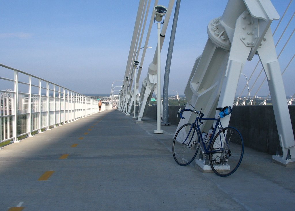
The biggest bridge and therefore the biggest hill in Charleston is the new Cooper River Bridge that opened in 2005; a beautiful suspension bridge that the planners had the wisdom to add a pedestrian and bike path. The bridge replaced two older bridges one built in 1929 and the other in 1966 both very narrow with no shoulder so impassible on a bicycle.
Before the new bridge opened it was not possible to ride a bike from Charleston to Mount Pleasant on the other side. So if you wanted to ride this area and the adjoining beach communities of Sullivan’s Island and The Isle of Palms you would first have to transport your bike over by car.
Having been back on my bike for a month I felt I had to go ride the bridge, as I had driven over it many times in a car. Charleston is a peninsula with the Cooper River on one side and the Ashley River on the other. The two rivers meet to form a bay and natural harbor, which is why Charleston was built there in the first place.
As I live in West Ashley which is actually south of that river for whatever reason I had two rivers to cross. The first bridge I chose to cross the Ashley River was the Cosgrove Road bridge which is a main connector to the Int.26 freeway to Columbia and extremely busy during the week. However early Sunday morning the traffic was light enough to not be a problem.
Cosgrove took me into North Charleston and then right onto Rivers Avenue, which I assume was the main road into Charleston before the freeway was built. A typical neglected and rundown old highway that you see all over the East Coast; wide enough but made up of concrete slabs with gaps in between just the width to drop a bike wheel in.
Traffic was still light and Rivers Avenue became King Street which is one of the main streets in downtown Charleston. The towers of the Cooper River Bridge were now in sight and soon the road veered left and over to Bay Street. I spotted a crowd of road cyclists congregated on the opposite side of the road.
“Is this the entrance to the bike path?” I asked. I was told it was. The path divided into two lanes with a yellow line down the center; I naturally rode on the right. After being yelled at by a few runners I discovered the right lane is for runners and walkers and the left lane is for bikes. Interestingly enough it changes on the way back and the right lane is for bikes.
A long steady climb of maybe two miles to the top I soon realized with my old skool six speed 13 to 18 rear cluster I was over geared especially when other roadies blew right by me pedaling much lower gears. But as this is the biggest hill in Charleston I decided to deal with it, get out of the saddle and muscle it to the top. I thought to myself, riders in California and Colorado where they have mountain passes rising thousands of feet would scoff at this climb, and if I couldn’t climb it on 42 x 18 (63 inches) I have no business being on a road bike.
I reached the top and coasted down the other side, got to the bottom, stopped and checked the time; I was one hour out from home. I turned right around and headed back. The climb on the Mount Pleasant side is shorter and steeper and about half way I realized I had not given myself enough time to recover and I was not going to make it all the way to the top.
Luckily I had my camera with me and I could stop on the pretext that I wanted to take a few photos. I was snapping the view up the incline when this guy in the orange shirt came running down.
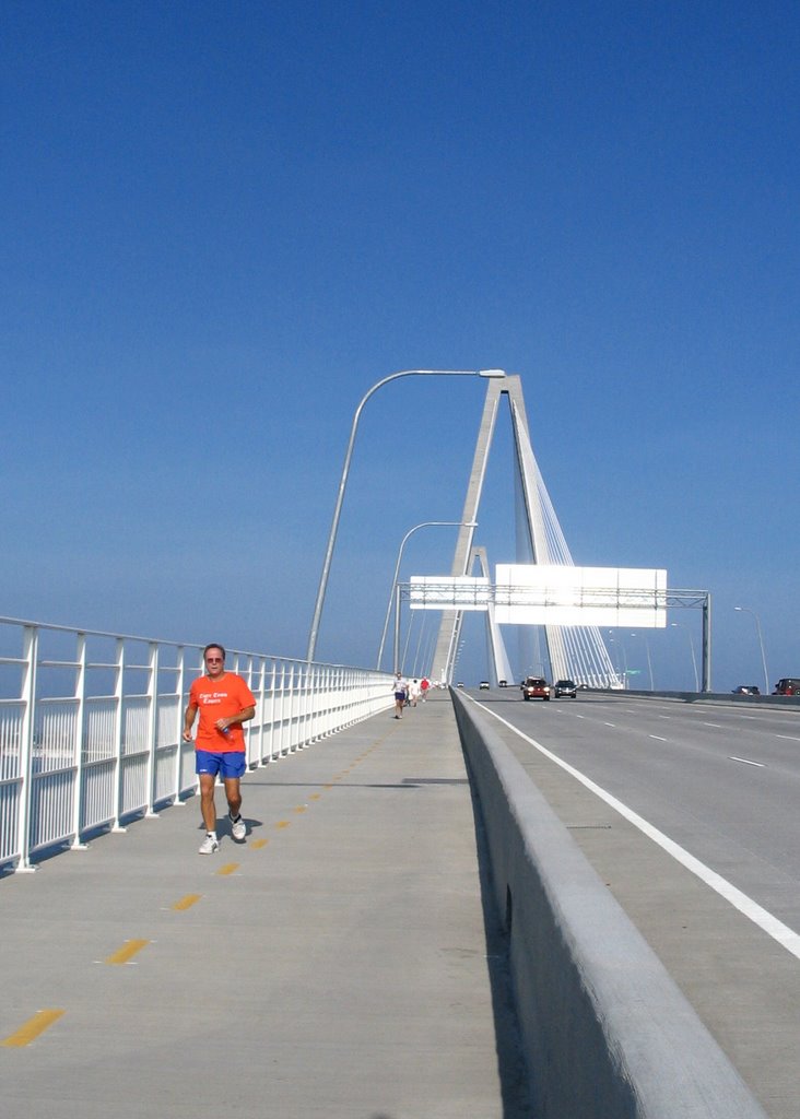
He offered to take my picture which I thought was very nice of him; or maybe he was looking for an excuse to stop also.
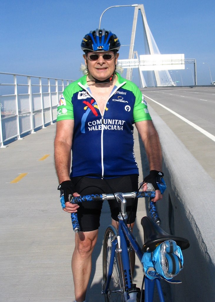
After putting the camera away and taking a good long drink of water; I got back on the bike and stomped it all the way to the top. I stopped and took a few more pictures at the summit. I rode home the same route and arrived home still feeling good having been out for about two and a quarter hours.
The next time I ride the bridge I plan to continue on to The Isle of Palms and ride along the coastline which will be a very pleasant ride. But I want to get a few more miles in my legs so I can get over the bridge keeping up with the other local roadies.


1 comment:
My wife and I rode this bridge on clunker coaster-brake bikes our hotel loaned to us.
Yeah, nice bridge.
Post a Comment